closer to home
Not every journey begins with a flight or an itinerary.
These posts are about shorter walks and familiar places - moments taken close to home, often without much planning, and sometimes without much certainty about the weather or the outcome. They’re small adventures, shaped more by mood, season, and pace than by distance.
Some are purposeful, others simply a reason to get outside. Together they form a quieter record of movement, noticing, and the perspective that often arrives when walking becomes the point rather than the destination.
Cold Air, Familiar Paths - Clipstone
The air felt very different to just a week ago.
Instead of walking in bright sunshine and 33-degree heat, we were now back in the grey, slightly damp, eight-degree East Midlands. England again. Properly England. Low cloud, muted colours, and that familiar cool smell of woodland and wet earth.
This was our first walk since getting home, a recce for leading the Pathfinders group again after our extended holiday. It quickly became clear that a few weeks of hotel breakfasts, buffets, and long coach journeys had not done our fitness any favours, but we set off anyway, determined to get round whatever the pace turned out to be.
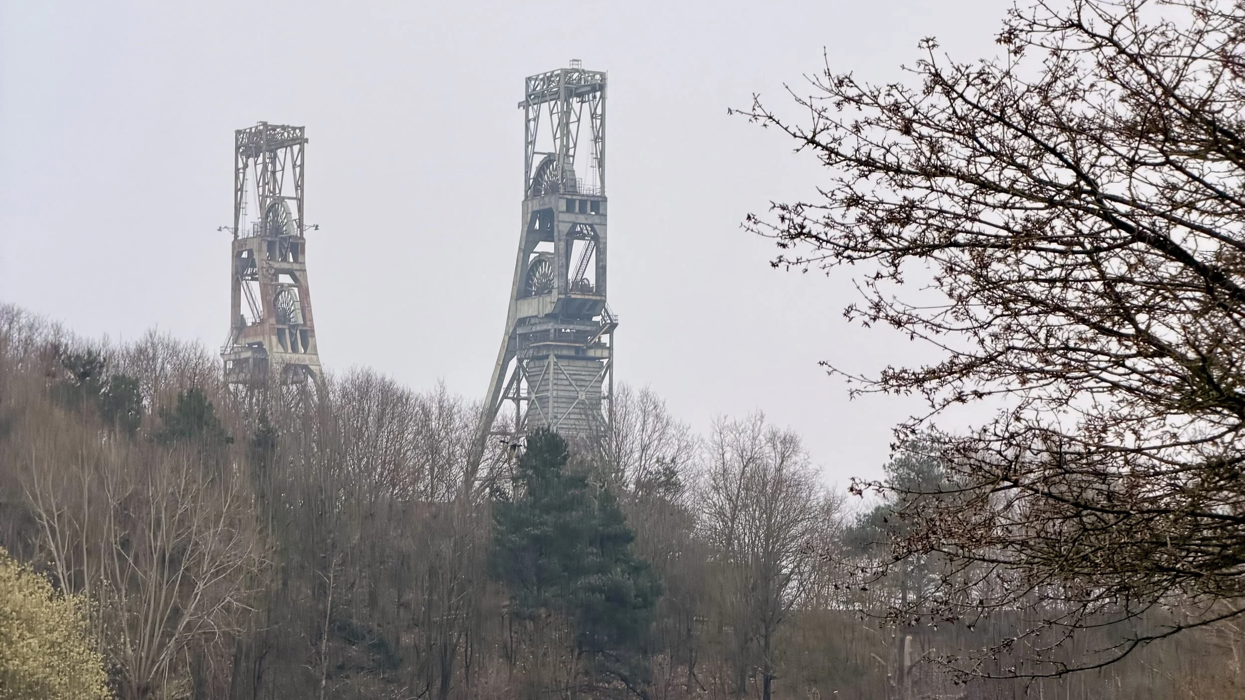
The Headstocks at Clipstone
We chose a six-mile circular route around the heathland and woodland on the edge of Clipstone, in north Nottinghamshire.
It’s an area we know quite well, but one that always seems bigger once you start walking rather than driving past it.
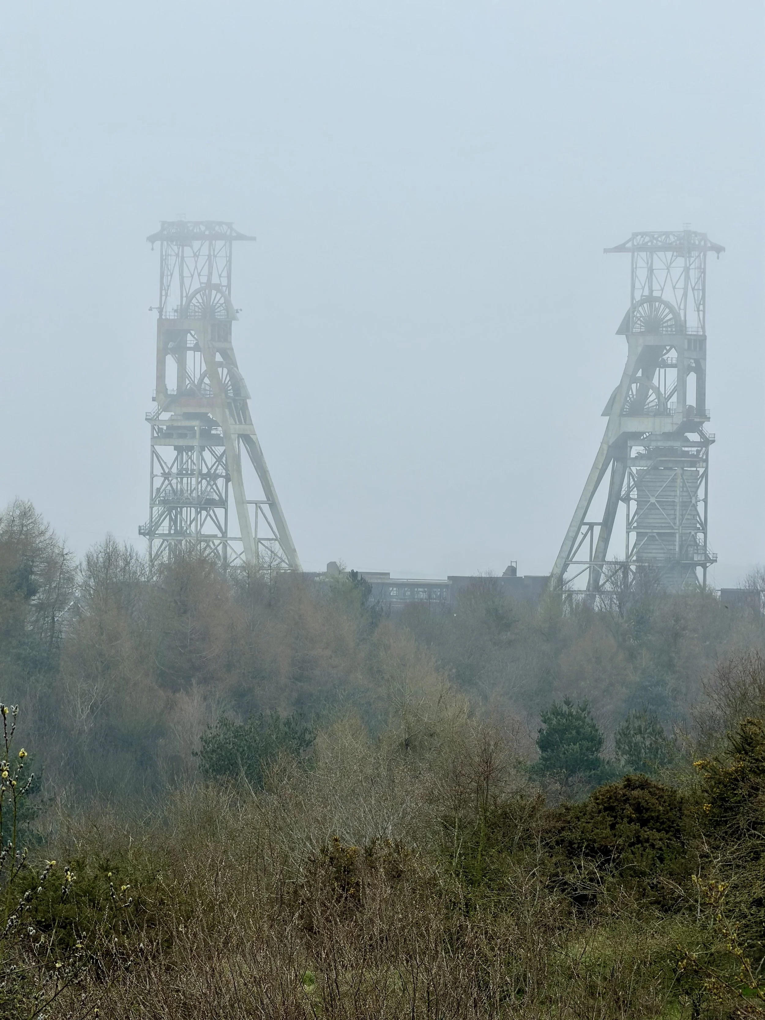
Clipstone itself is a former coal-mining town, and the past is never very far away here. Not long into the walk, as we climbed up onto the higher ground, the twin headstocks of the old Clipstone Colliery appeared through the haze, standing above the trees like something from another era. Even in the mist they dominate the skyline, a reminder of when this whole area revolved around the pit. They look almost skeletal now, but still strangely impressive.
The climb up to the heath felt steeper than it probably was, though that may have been more to do with jet lag and buffets than the gradient. At the top we reached the open ground of Bower Hill Heath, where the landscape changes to rough grass, gorse, and low scrub, with wide views across Sherwood Forest and the surrounding farmland when the weather allows it. Today the view faded quickly into grey, the distance disappearing into mist.
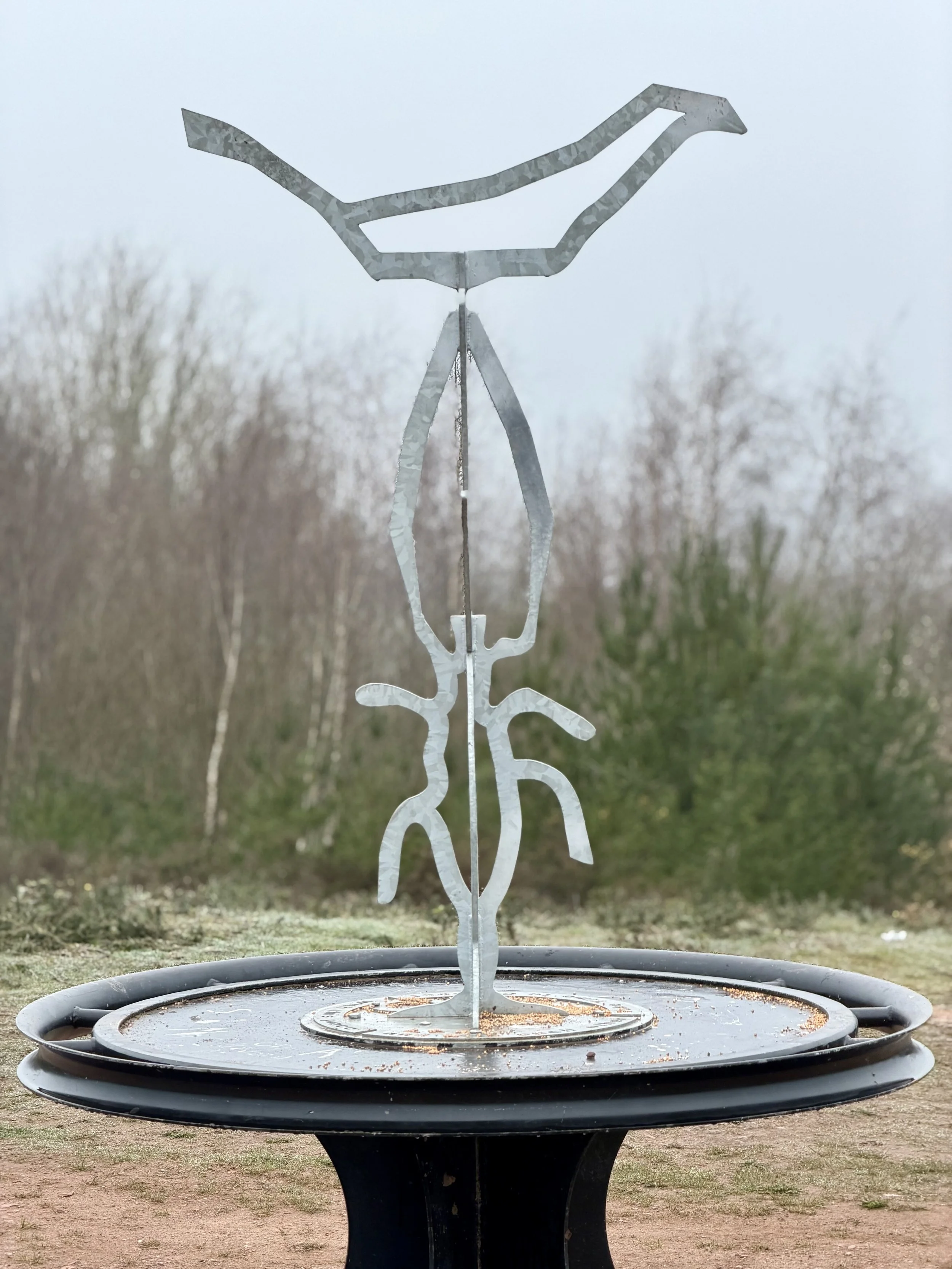
A sun dial sculpture in the park
At the summit stands a small metal sculpture, one of those pieces that probably means more than it looks. Against the dull sky it had a slightly ghostly feel, the thin metal shapes outlined against the cloud, with the colliery headstocks faint in the distance behind it.
Despite the weather, the heath was full of birdsong.
For such a dull morning it felt surprisingly lively. My birdsong app suggested dunnocks, chiffchaffs, and even a Eurasian siskin — which sounded like the app might be making things up, but the noise was definitely there. Spring was clearly starting, even if the sky hadn’t noticed yet.
From the heath we dropped down the far side, following tracks that wound past small ponds and wet ground before reaching the edge of the Crown Estate, and a road we often travel along. Turning off onto a narrower trail, we found ourselves on a long straight path that looked as though it might once have been an old railway or service track, running arrow-straight between banks of gorse and scrub. It seemed to go on forever, the kind of path that feels short on a map but not on your legs.
Eventually the track led into deeper woodland, the ground soft with leaves and the trees tall and bare, just beginning to show the first signs of spring. Somewhere along the way we passed an old boundary marker and a few weathered signs pointing towards High Hazel Coppice, names that sound as though they have been here far longer than the paths themselves.
We hadn’t really realised how much woodland there is around Clipstone until walking it properly. From the road it never looks like much, but once you are inside it feels like a proper stretch of forest.
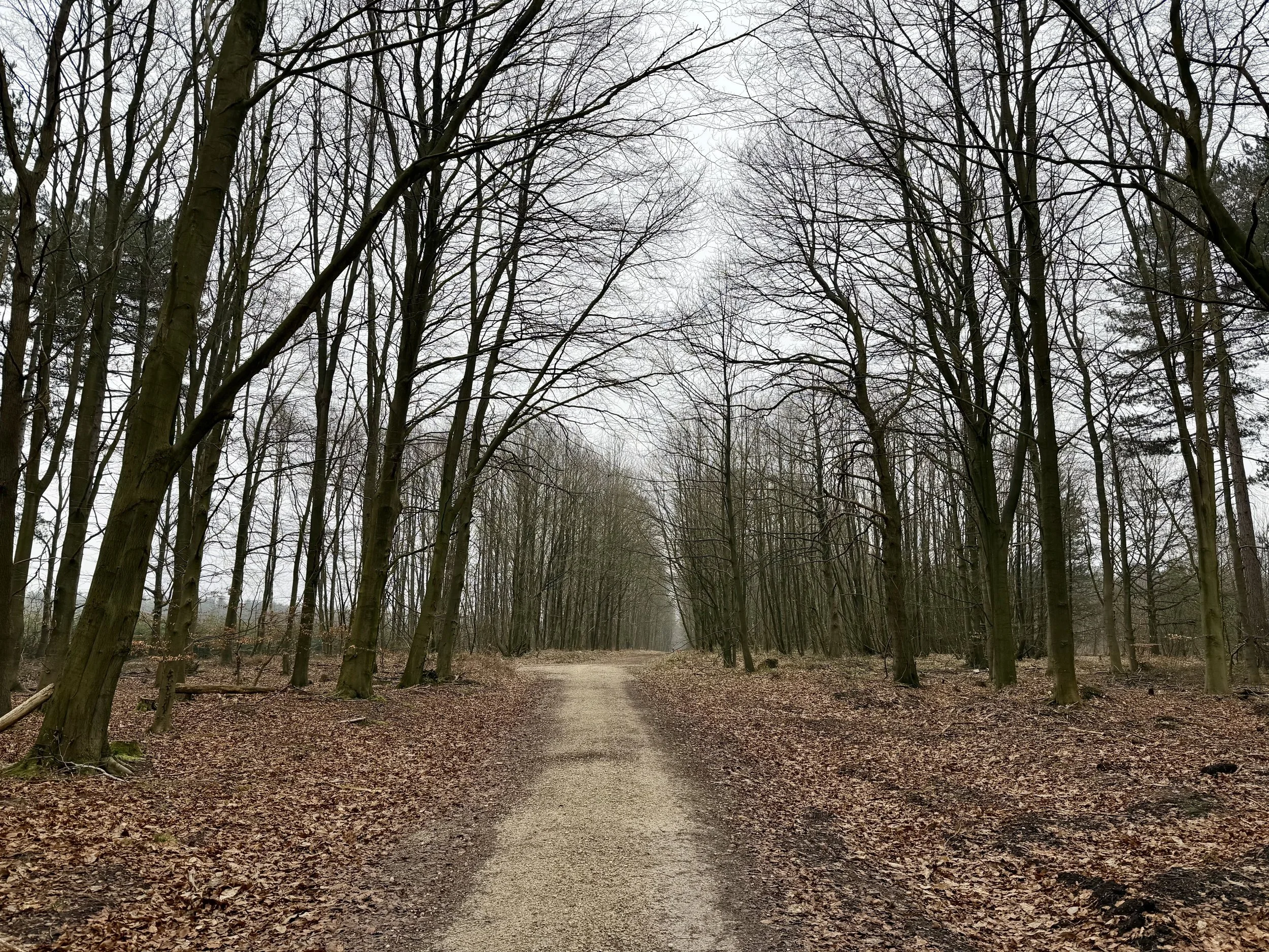
Forest at Clipstone
The route eventually brought us back towards Vicar Water, where the lake lay still under the grey sky, the surface reflecting the trees and, in the distance, the colliery towers again.
We passed another walking group near the water, a friendly lot who turned out to be called Steps for the Soul, one of those local groups that seem to know every path for miles around. One of them lived nearby and was leading the group though their ‘backyard’..
By the time we reached the end, our legs were definitely feeling it, but we had made the full six miles without needing to shorten the route, which felt like a small victory after the holiday.
We finished, as most good walks should, with coffee at the café by Vicar Water.
And, fitness permitting, we should be ready for Pathfinders next week.
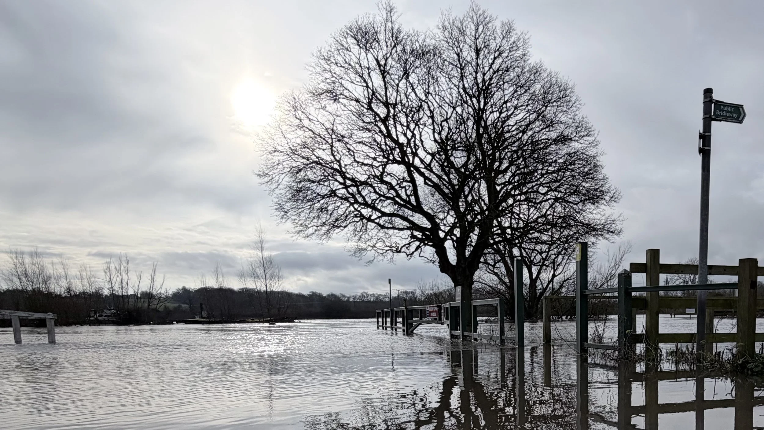
Where the Path Disappears - Gunthorpe Lock
4 miles | riverside walk | overcast with some sunshine | coffee at the pub
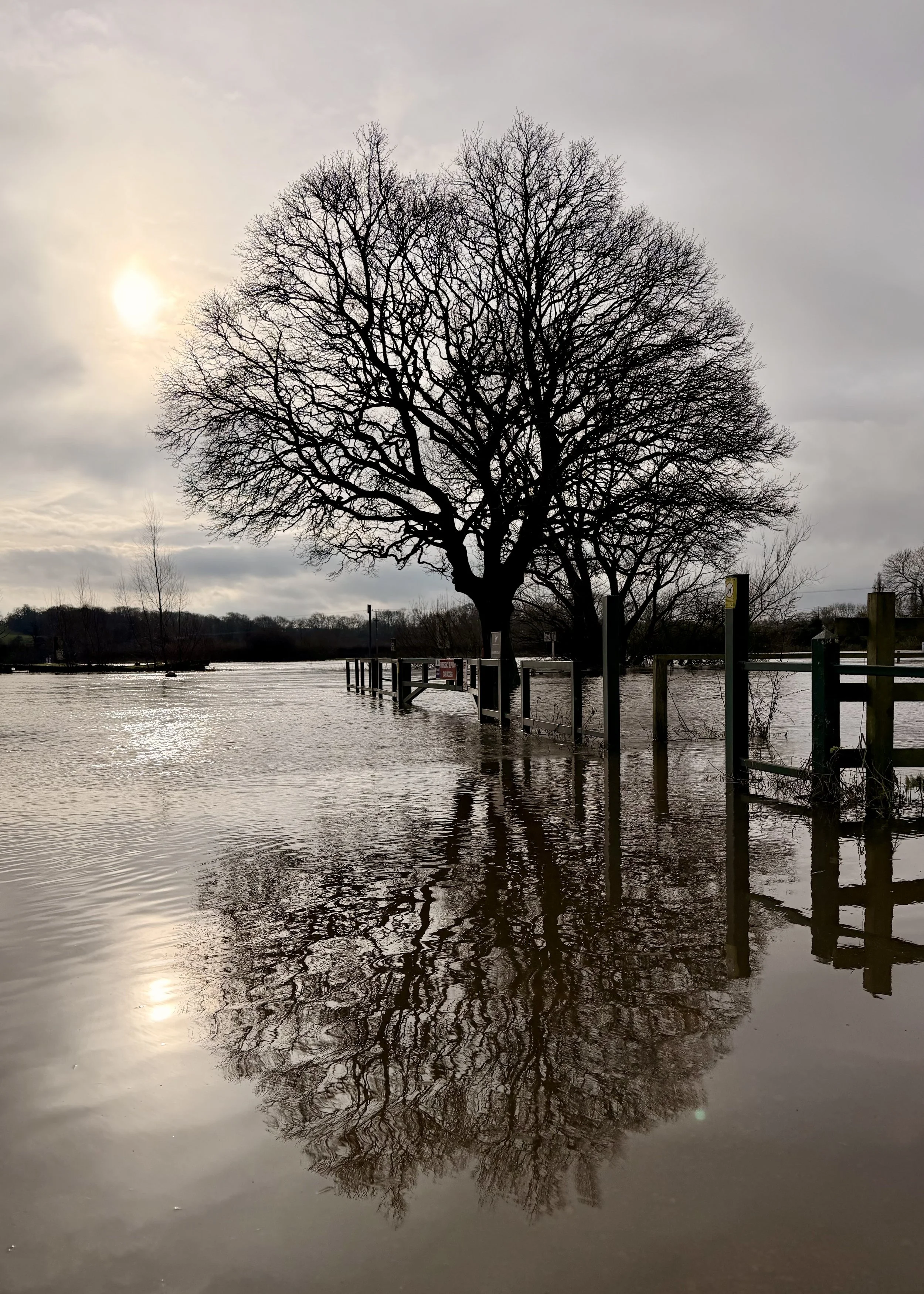
Flooded River Trent outside Unicorn Pub
Today’s walk was meant to be a recce for the February walk that we usually lead. As we’ll be in India when it’s scheduled, we did the recce with our friend Richard, who has kindly agreed to lead it in our absence. In that sense, it already felt like one of his walks, and for once I was simply following, not holding the route in my head.
We began at The Anchor in Gunthorpe. The River Trent was already wide and moving at pace, edging into places it doesn’t usually reach. From outside the Unicorn the riverside path looked usable enough, and we set off alongside the water, passing Gunthorpe Lock and the strangely out of place “No swimming” signs. It soon became clear that the river had other ideas. The path ahead was flooded, the way forward closed to us.
We turned back and walked through the village instead, then out into the fields where the ground was heavy with water. The morning was warming now, the sun lifting through broken cloud, and once away from the road everything softened and fell quiet. Footsteps slowed. Conversation thinned.
At the next turn, the fields shifted again — no longer just waterlogged, but openly flooded, the intended line of the walk dissolving into still, reflective water. There was no sense in pushing on. Some decisions don’t need discussion.
Over a very good coffee, we reflected that this probably wasn’t the right walk to lead after all. Even though the main walk is still a couple of weeks away, this was a timely reminder of why recces matter, not to confirm a plan, but sometimes to quietly rule one out.
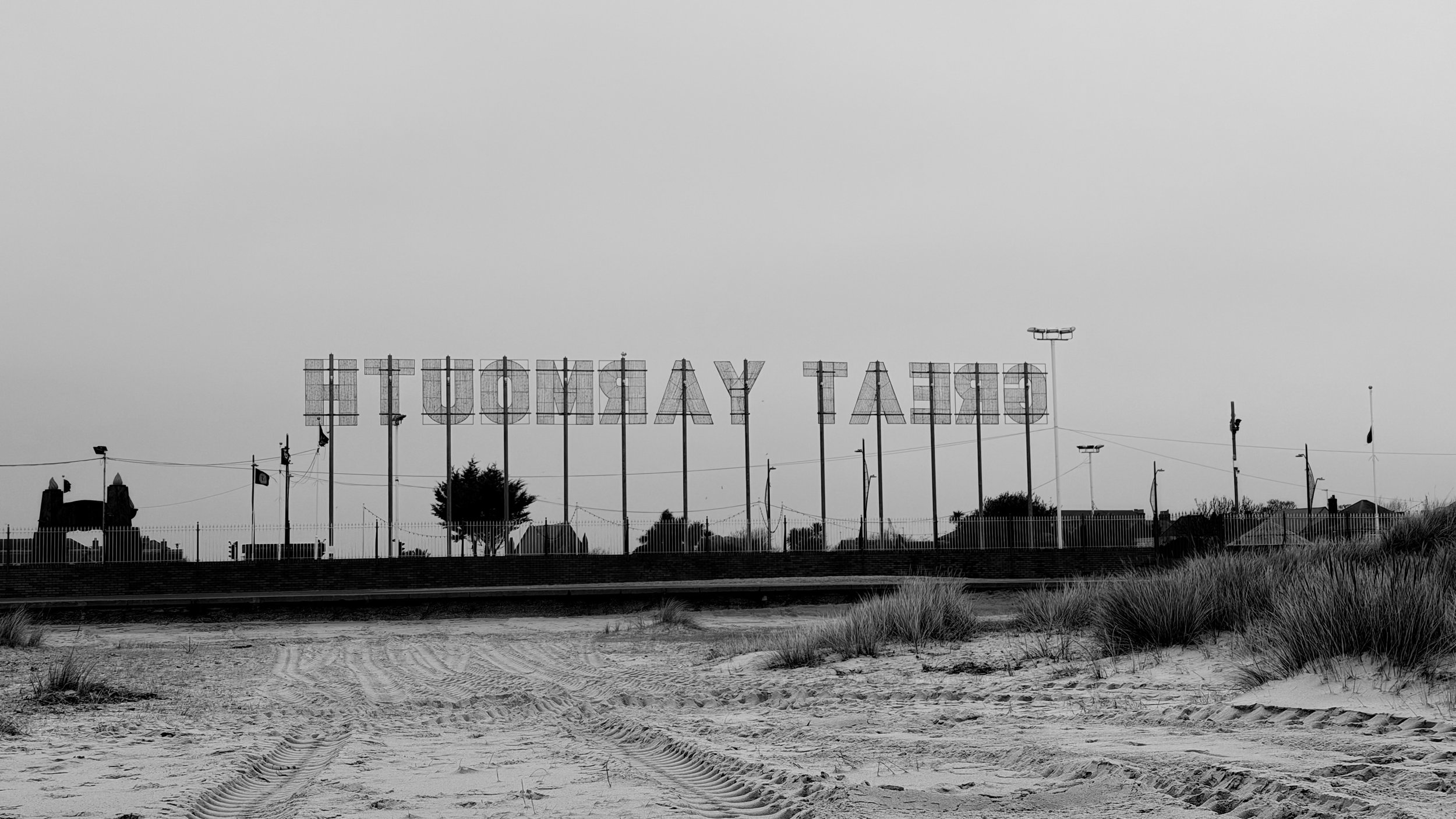
Out of Season — Wellington Pier, South Beach
2 miles | beach & promenade | grey low cloud | breakfast at hotel
A cold January Sunday morning found us walking north along Great Yarmouth’s wide, open South Beach. The sky was a soft, unbroken grey, the kind that flattens colour and sharpens detail. The air had that familiar coastal bite, not dramatic, just quietly persistent, enough to keep hands in pockets and collars turned up.

Great Yarmouth sign near the Pleasure Beach
The beach itself was almost empty. No families, no deckchairs, no summer noise, just sand stretching ahead and the muted rhythm of the North Sea rolling in. The absence of people made the space feel larger somehow, more exposed. A few joggers passed occasionally along the promenade, heads down, moving with purpose, while the beach below remained still and largely untouched.
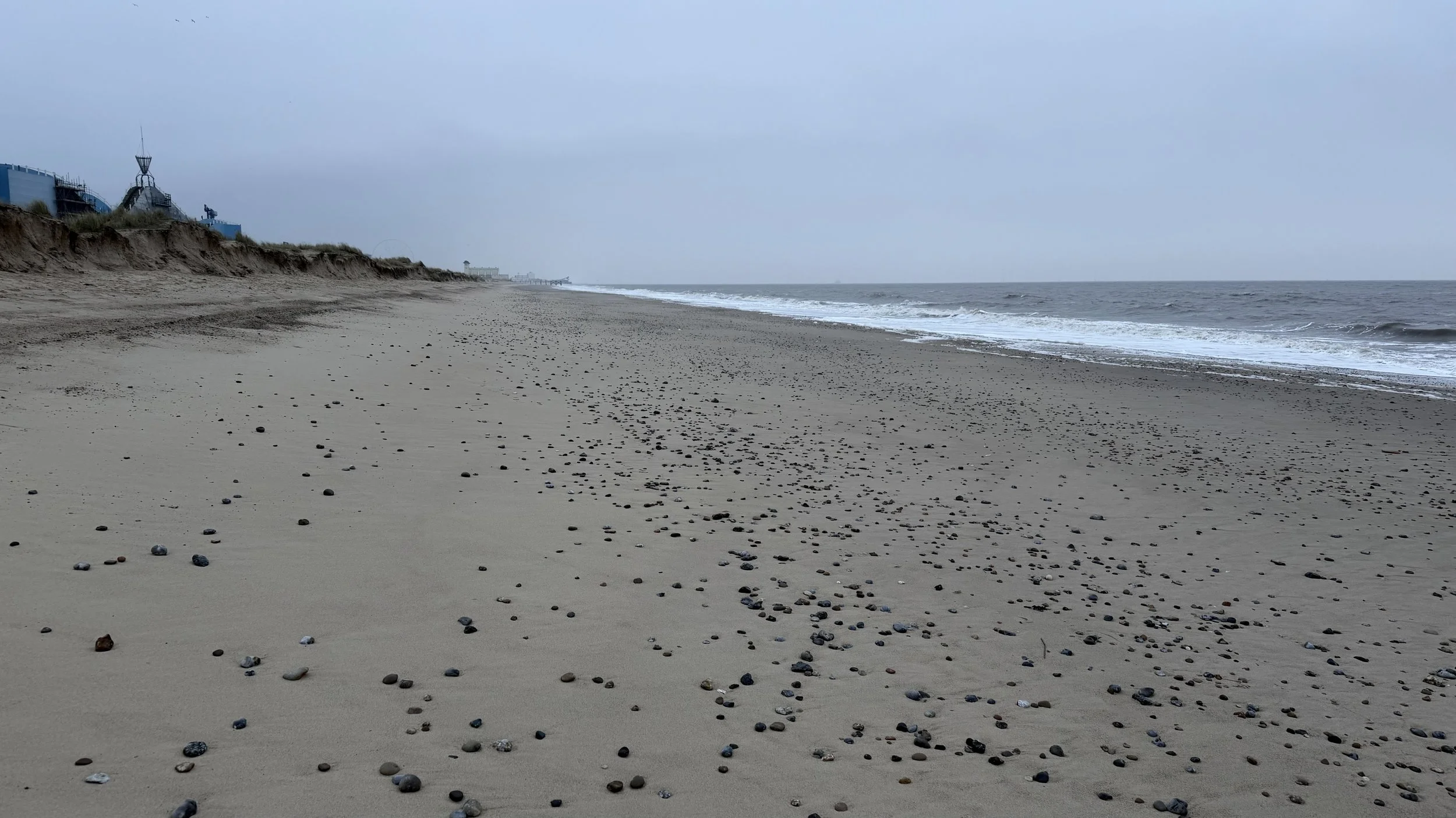
South Shore, Great Yarmouth
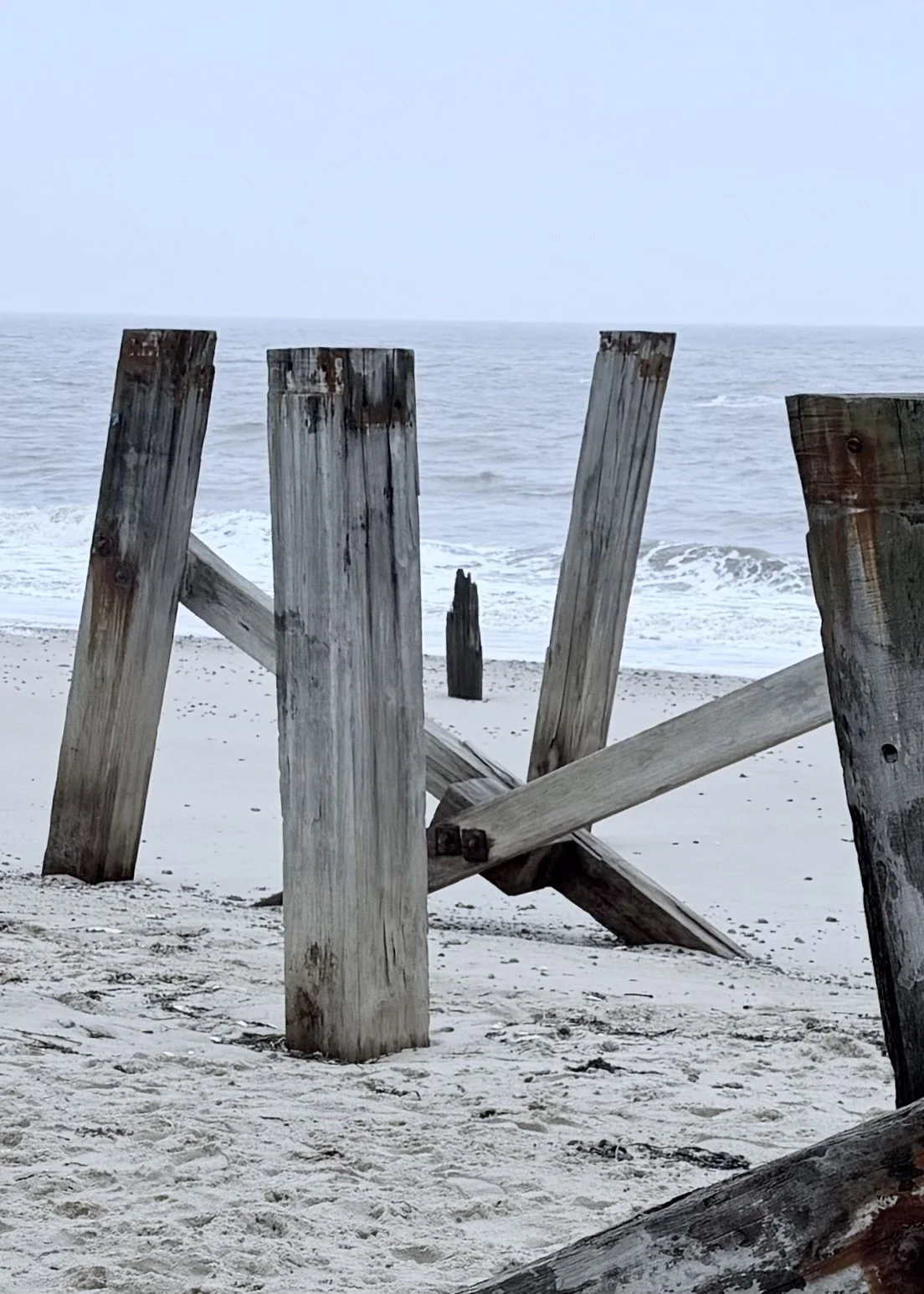
Wooden posts on South Shore
Along the shoreline, weathered wooden groynes leaned at uneven angles, their surfaces darkened by salt, rust, and years of tide. They felt like markers of time rather than structures, reminders of how long this coast has been holding its ground.
As we walked north towards Wellington Pier, the familiar seaside landmarks appeared slowly through the haze. The pleasure beach buildings sat quiet and closed, waiting for warmer days, while the ferris wheel stood motionless against the sky, stripped of its usual brightness.
The cold kept the walk short, around two miles end to end, but one that suited the season perfectly. No views demanding attention, no highlights to chase. Just space, movement, and a sense of unease as colour, noise, and people seemed to have slipped quietly away.
Sometimes a winter walk isn’t about where you’re going at all, just about being out there when almost no one else is.
If you’d like to follow future journeys, reflections, and moments noticed along the way, you can join the mailing list here.

Walking Anyway — Gedling Country Park
4.5 miles | easy paths and gentle inclines | rain, mist, low cloud | cafe at visitor centre
Today we were in two minds.
We needed to complete a recce walk for next week’s shortish walk that we’ll be leading, but the weather offered little encouragement; steady rain, low mist, and heavy skies. Still, we went. Partly because the walk needed doing, but also because days like this remind us that not every outing has to be perfect to be worthwhile.
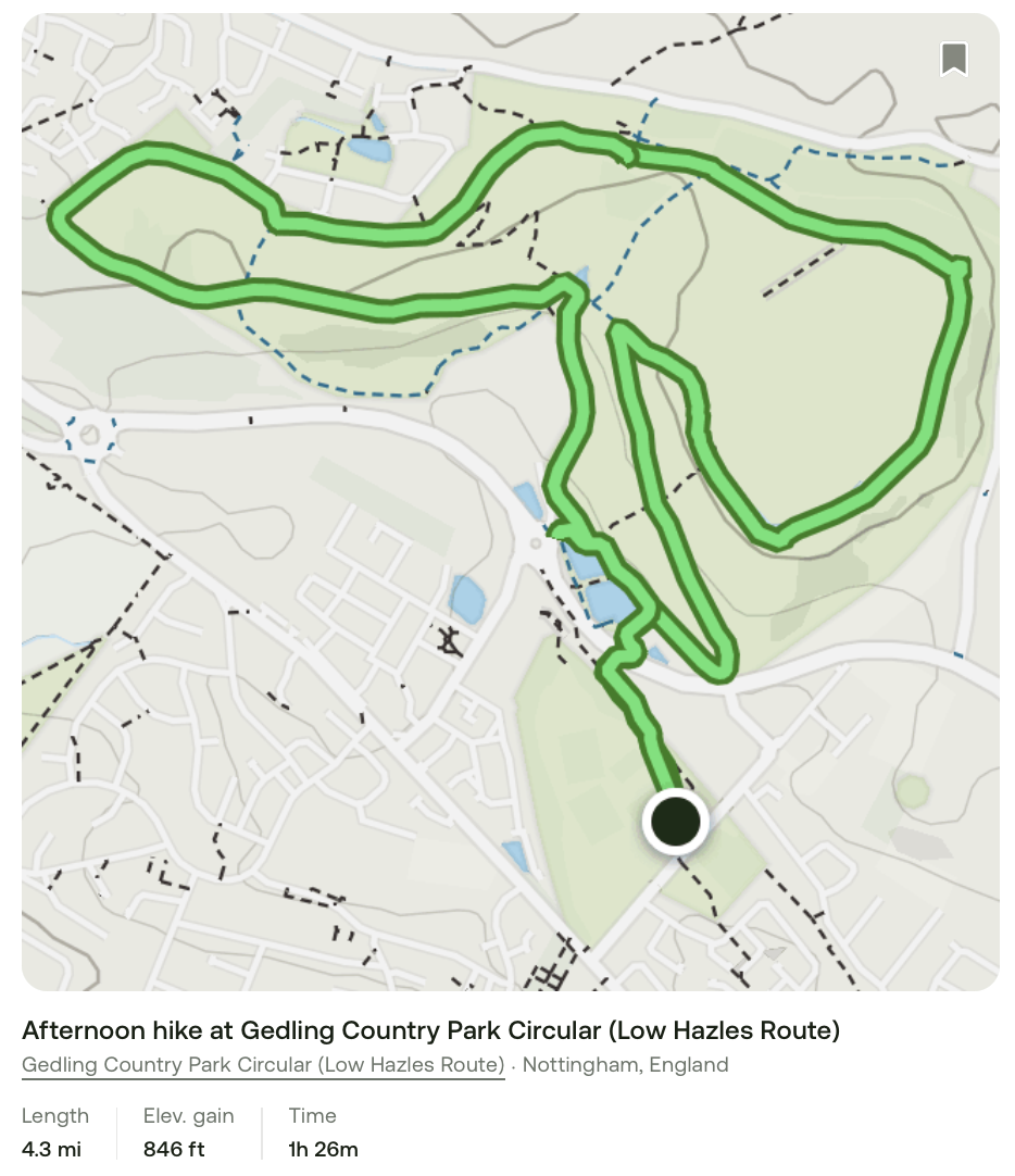
The route was an easy 4.5 miles around Gedling Country Park which is a substantial local green space with multiple trails, views, nature, and even heritage touches from its colliery past, just west of Nottingham. Straightforward terrain and familiar paths, with the AllTrails app ticking quietly in the background, recording distance rather than directing the journey.
We were well wrapped up, thankfully. The rain had little intention of easing, and the higher ground near the Millennium Torch was exposed, with no shelter to speak of. It was the sort of weather that narrows your focus; head down, hands warm, steps steady.
Even so, people were still out walking. Others had gathered in the visitor centre, drawn by warmth and routine as much as coffee. We joined them briefly before heading back out.
By the time we set off on the second part of the walk, the rain had softened. We paused at the memorials, one for Queen Elizabeth II, another marking the colliery that once stood beneath the park. Quiet reminders that landscapes, like lives, are layered with what came before.
When we had finished, felt better for it. The body loosened, the mind settled, and the day had gently shifted shape. Although simple and low risk, the route is now confirmed for next week. More than that, it had been exactly the walk we needed.
If you’d like to follow future journeys, reflections, and moments noticed along the way, you can join the mailing list here.
Fields, Woods and Water - Anston to the Chesterfield Canal
6 miles | fields, woods and canals | overcast with some sunshine | homemade provisions
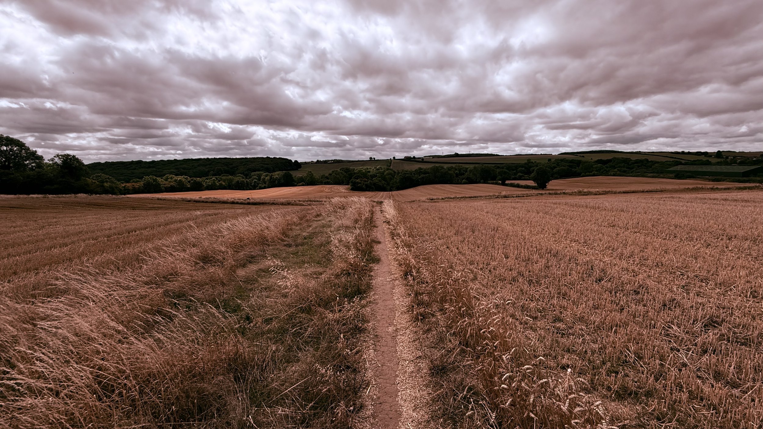
The walk begins plainly enough. A parish hall car park, a recreation ground, and then a path leading out into open countryside. Fields lie recently harvested, the sky wide and unsettled, and the landscape already beginning to change underfoot.

Stubble fields near Anston
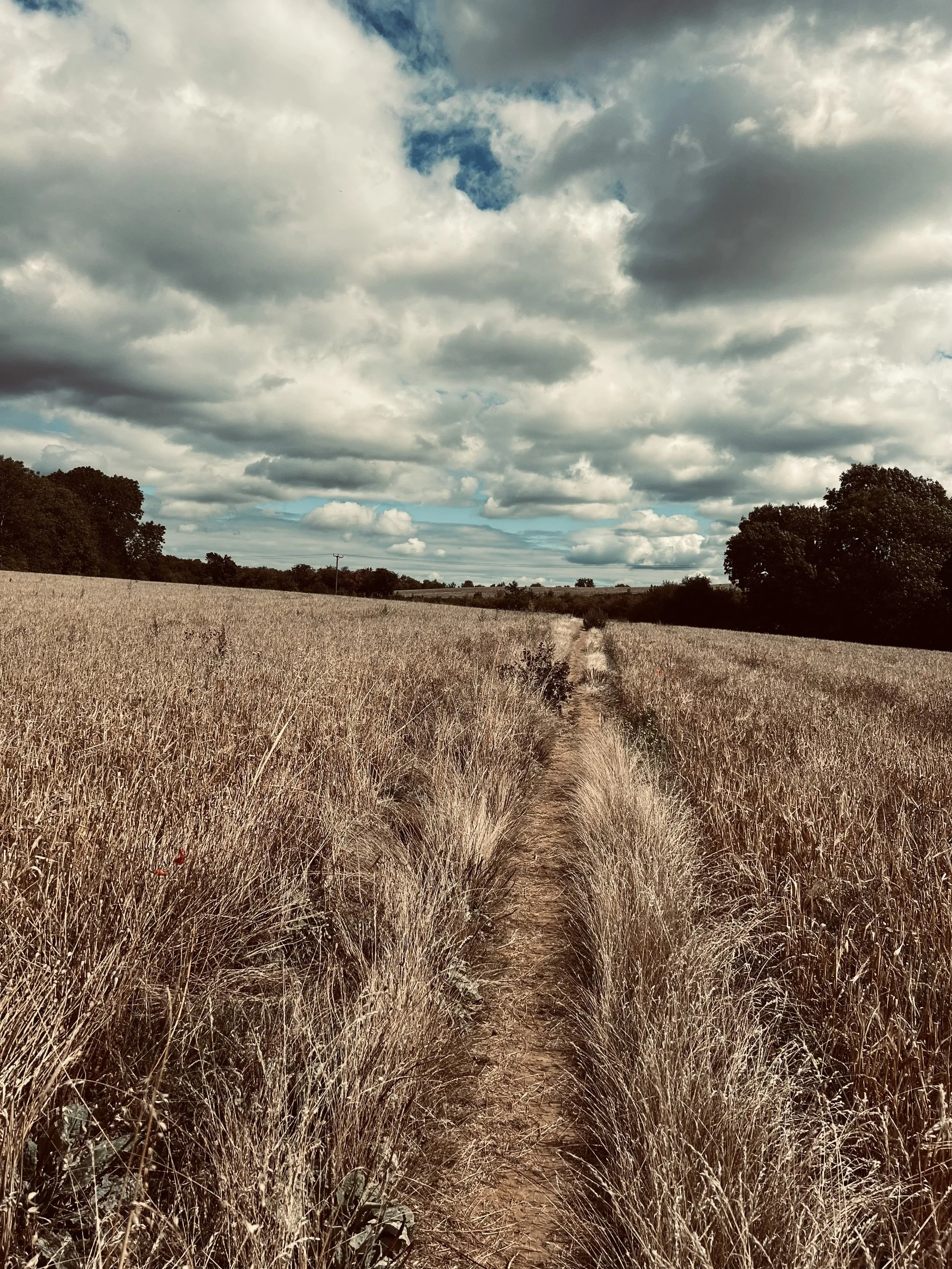
Stubble fields near Anston
There’s an ease to walking here. The land rises and falls without drama, leaving space to notice the textures of the route, stubble underfoot, hedgerows edging the fields, woodland waiting ahead.
The character shifts as we enter Anston Stones Woods. The space tightens, light filters through leaves, and limestone rock faces draw closer to the path. Roots twist and grip the earth, shallow caves appear along the gorge, and the woods feel shaped by something older than the trees themselves.
This is a place formed during the Ice Age. The woods have yielded remarkable discoveries, including hyena bones in Dead Man’s Cave dating back around 125,000 years. Today, that history lies beneath birdsong, shade, and the steady pace of walking.
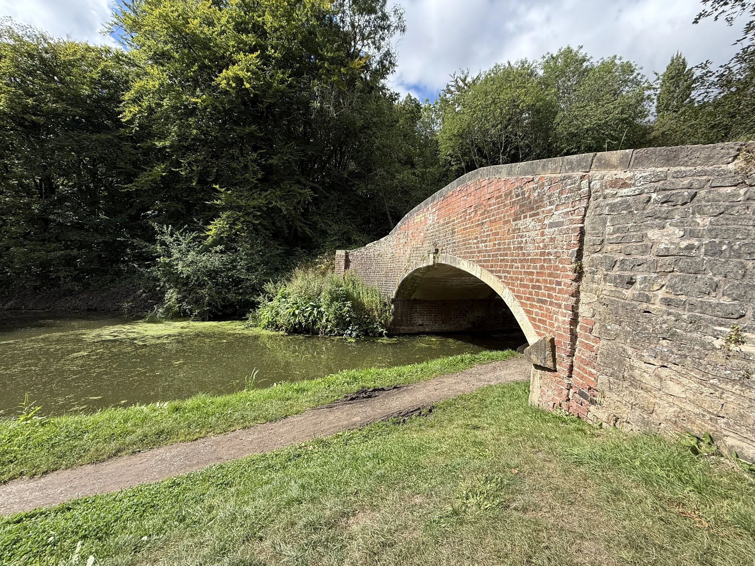
Beyond the gorge, the route opens again. Meadows and woodland alternate, Anston Brook slips beneath our crossing, and the modern world edges back in near the A57. Fine houses border Lindrick Golf Course, their order contrasting with the ground we’ve just left.
Farmland carries us onward to the linear presence of the Chesterfield Canal. The water is still, green with duckweed, shaded by trees leaning over the towpath. It’s a place that naturally slows the pace or requires a break.
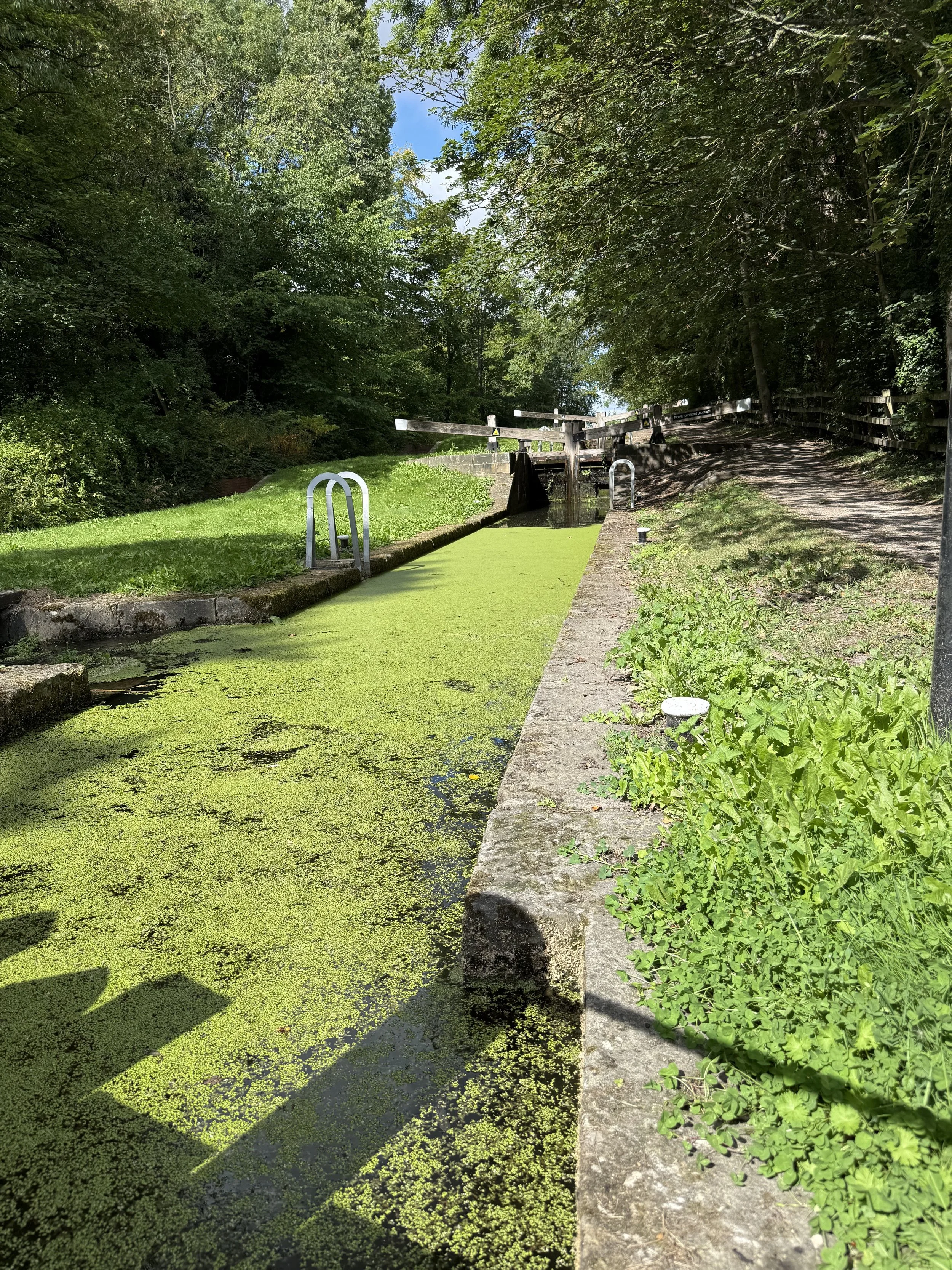
Following the towpath along the Cuckoo Way, we pass the Triple Lock staircase - solid, purposeful, and settled into the landscape. What was once built for movement and trade now feels part of the scenery.
The loop closes through South Anston and back across the A57 to where we began. Nothing marks the ending dramatically, just the sense of having stepped away from the everyday for a while.